Monday, November 16, 2009

Random Hacks of Kindness First Prize!


GeoCam Disaster Response Project members were on the First Prize team "I'm OK". From left to right, Chris Cinelli, Otavio Good, Eric Park, Trey Smith, and Ted Morse. (Our iPhone hacker Hansel couldn't stick around for the awards.)

The Random Hacks of Kindness disaster relief codejam was this weekend. RHoK was an unconference run by all the attendees, not just a few organizers. The goal was to hack together new tools to help in disaster relief. Before the conference, people submitted problem definitions -- their sense of gaps in disaster relief where innovation could make a difference. At the conference we broke up into teams to create open source software and process ideas to address those problems.

Our team "I'm OK" addressed the problem that urban cell networks get bogged down in disasters with people calling their loved ones to tell them they're ok. To address this, we created a mobile phone app called "I'm OK" with just one button. It sends a single SMS to a server that in turn notifies all your friends and family that you're ok through whatever services you use to connect with them, like SMS to their phones, Facebook status update, Twitter update, etc. This is particularly useful because SMS messages don't burden the cell network as much as phone calls, and can often get through when calls can't. Half of the team was GeoCam project members (Eric, Ted, and myself), and we picked up some new friends along the way (Chris, Otavio, and Hansel).

Here's a few more photos.

FEMA Director Craig Fugate gave the keynote address, where he introduced the problem of encouraging people to make a family disaster plan before the disaster strikes.

I talked about NASA's involvement in disaster relief.


My slides.

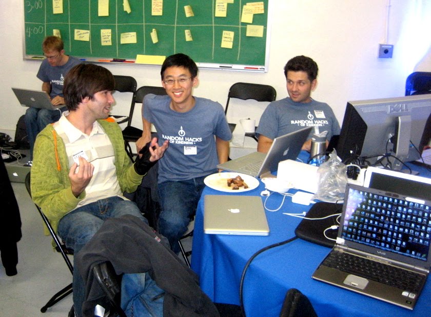
The team was pretty exhausted by Saturday morning, but the free food helped :)


The presentation Eric gave about "I'm OK". Otavio did most of the slides.

The I'm OK app running on Android and iPhone. (Credit: Elinor Mills, CNET)

Friday, October 30, 2009

Loma Fire 2009/10/27


Santa Cruz County Sheriff Phil Wowak (far right) listens as a resident says he did not receive the evacuation warning from the county's reverse-911 system.

Tuesday was our last day at the Loma Fire. With activity slow on the fire itself, the most interesting event was the community information forum in the evening, where all the public agencies involved in the response discussed what happened with local citizens and listened to their concerns.

It was great to see this, because we're embarking on a new initiative called the Citizen Responder Project, which aims to empower citizens to better help each other in emergencies through use of information technology and social media (more on that in future posts). This fire may become our first case study.

The forum started with several presentations explaining things like how the fire progressed, which roads were closed and why, and how the evacuation warning was sent out using the county's reverse 911 system.


A CAL FIRE representative talks about the history of fires in the area. The Loma Fire is in red and the 2008 Summit Fire is in yellow. (It was neat to see this map, as I was in the GIS trailer when Joe Larson was preparing it.)

Then there was a wide ranging open discussion. Some residents were very expressive about not liking road closures that kept them away from their homes. Very calm professional responses from the presenters kept that thread from getting out of hand.

The part that interested me the most was a discussion of how citizens could stay informed. The people who listened to the radio complained about the quality of information. For example, one woman spent an extra hour driving home because she couldn't figure out which roads were closed. Most media reports were targeted at audiences outside the community and left out the details local residents care about most.

Other residents said that their local Facebook friends were the best source of information. Alex Leman's Loma Prieta Fire Twitter feed was also mentioned as a good way to keep up. Somebody asked how they could stay updated when they were away from home, and the advice was to call a neighbor who's always on the computer. Other communication methods were brought up, like a call center to answer questions or a physical bulletin board for official postings. It was interesting to see how different residents had different levels of comfort with official vs. informal channels, which seems to be related to computer literacy and level of social involvement in the community.


Loma Prieta Fire Chief and Community Emergency Response Team organizer Alex Leman (top left) tells citizens how they can get involved in response.

At the end of the evening I talked to a few of the presenters and got some business cards, so as soon as we figure out what questions to ask we should be able to follow up with them to get more impressions of their experience with this response. The forum was a great wrap-up to our involvement in this fire.

Monday, October 26, 2009

Loma Fire 2009/10/26

Darren Stewart taking photos from the passenger seat of a helicopter.

Today's highlight was a visit to the San Martin Airport where they run helitack for the Loma Fire. One of the helicopters (an Aerospatiale SA-315B "Lama" type 3) took a GeoCam phone aboard on a recon flight, collecting more than 80 photos. The start of the fire is still under investigation -- many of the GeoCam photos were taken near the point of origin and will remain embargoed until the investigation is complete.

The fire was quiet today with light winds. The team was really trying to put it to bed before a cold front comes through tonight with much stronger northerly winds, predicted to gust locally up to 45 mph. If the wind manages to push the fire across the containment line and Highland Way to the south, the fire will be moving upslope again and things could get hairy.

Other things going on -- we met a whole bunch of folks on ICT 3 and had some good technical discussion with the GIS specialists about ways to improve our data export. Here's a bulk export of many of today's GeoCam photos (cleared for public release).

I'll leave you with some more of the nicer photos.

Loma Fire wide view from the southwest at about 3000'. Fingers of activity move slowly downslope on the south side, zero flame length.

San Martin airport from the air. The helicopters in the foreground are a Sikorsky S-64 "Skycrane" (Type 1) and possibly a Bell 407 (Type 3).


Field observer debrief in the GIS trailer. Observers Steve DeBenedet (left) and Rick Wonneberger (right) are debriefing with GIS specialist Jonathan Pangburn (center).

Sunday, October 25, 2009

GeoCam deploying to CA-CZU-Loma fire

Retardant drop at the Loma Fire Credit: dandawson on flickr

GeoCam has just been invited to deploy to the Loma Fire on the border between Santa Clara and Santa Cruz counties.

The fire takes the name "Loma" from Mt. Loma Prieta, which many people will recognize as the epicenter of the last major earthquake to hit the Bay Area in 1989. The fire started this morning, Sunday Oct 25, at 0425. The area got 10 inches of rain recently, but that wasn't enough to wet down the heavy fuels, and northerly winds up to 30 mph didn't help. According to the last update, the fire covers 800 acres, 0% containment, and growing fast.

The area is in a canyon along the San Andreas fault, hard to access from the ground, and lots of air resources have been called in. CAL FIRE is deploying Team 3 (a Type I team) to the fire. They will take over after a transition meeting at 2000 tonight.

We were invited to the fire by Jeff Gahagan, the comm unit leader for Team 3. We happened to meet him a couple of months ago at the Lake/Napa Unit Emergency Command Center in St. Helena where we staged the phones for fires in the Sonoma area -- we trained him on using the phones and he's seen the web interface as well.

More resources:

Tuesday, October 6, 2009

Lanny Lin Talks About the Guiberson Fire

My name is Lanny Lin, and I am a PhD student from the Computer Science Department at Brigham Young University located at Provo, Utah.

During summer 2009, I had the great opportunity to work as an intern for the Intelligent Robotics Group at NASA Ames, and GeoCam is the project I worked on under the management of Trey. Although I am back at BYU now, I am still working on GeoCam development and researching on how GeoCam can effectively support disaster responder operations.

After the Guiberson fire started, Trey and I were invited by Tom Z to the Incident Command Post, located at the city community center of Moorpark, CA, to deploy the GeoCam system and investigate how GeoCam can support the firefighting process.

Trailers used as temporary offices by firefighters using the Moorpark community center.

The Guiberson fire is a type I fire that burned over 17,000 acres, and involved over 1,000 fire personnel. It was in an area very close to several communities and many avocado farms. The fire started on September 22, and by the time I flew in on September 25, the fire had been almost contained. However, we were still able to let the damage assessment team and the rehabilitation field observers team use GeoCam in their post-fire operations. We also introduced GeoCam to firefighters from various divisions, groups, and regions, and discussed how GeoCam might be useful in their daily operations.
Trey giving training about how to use the Android phone with the GeoCam Mobile software to the rehabilitation team.

Geo-tagged photo taken by Field Observers and uploaded to GeoCam server in real time using the Android phones we provided, showing the dozer line that prevented the fire spread.

Tom, Trey and I also drove along the fire line and documented the area of the fire. Although most of the fire had burned out, it was still very exciting to see mountains and peaks that were entirely black from the fire. We also caught several small fires that were still burning within the fire line.

Small fires still burning near the fire line.

Tom taking a picture with the Android phone using GeoCam mobile of Lanny videotaping him using the Android phone.

We interviewed members of the incident command team, field observers, and GIS specialists (in charge of providing up-to-date maps), and these users provided us great feedback about the GeoCam system. People are very happy about the ease of training. It only takes minutes for a firefighter to become efficient in using the GeoCam mobile software running on the Android phone. Fire crews are especially impressed by GeoCam's real-time (within cell coverage) photo uploading capability. Normally, information only gets updated after field observers return to the base camp, which could be many hours after they collect the information. This capability reduces the information turn around time and also reduces the workload of the field observers after they return when they are exhausted and ready to hit the shower. The GIS specialists also pointed out that the ability to have field observers categorize photos using fire icons directly on the phone can be very helpful in reducing communication errors and workload for the map makers.

I flew out of LA on September 27. At the time, the fire was 85% contained and most of the units were demobilized. It was a very exciting three-day trip for me because it was my first fire. I hope GeoCam can become a useful tool in disaster response operations such as the Guiberson fire to make the firefighters job easier. These great, hard-working people put their lives on the line to protect residents and their properties. They deserve the best!

Tuesday, September 29, 2009

Tom Z Talks About the Guiberson Fire

[This is a guest post by our friend Tom Zajkowski . We can't pronounce his name, so we stick with “Tom Z”.] My name is Tom Zajkowski. I am a Remote Sensing Analyst with the Remote Sensing Applications Center located in Salt Lake City. Trey asked me to deploy with GeoCam to the Guiberson Fire to serve as a liaison between his team and the CAL FIRE Incident Command Team managing the fire.

The Remote Sensing Applications Center, part of the US Forest Service, continually works with NASA to evaluate technology that can help the FS and other land management agencies fulfill their mission. We always seem to begin with fire applications as they elicit the most interest from management and the public. GeoCam certainly has fire applications, and it can also be used in other applications within the FS, like recreation planning and resource management.

Screen shot of the GeoCam Share map of the Guiberson Fire, as viewed in Google Earth.

I was impressed with the GeoCam utility. As Trey has posted previously there were some issues but that is to be expected on a first or even second deployment. As you can see from the map we were able to collect images from all over the fire. We got a lot of excellent feedback from the fire fighters that will allow us to build on this experience for our next deployment.

I was able to get one of the phones from Trey which I will use to develop a training pamphlet and a brief so that we can help firefighters learn how to use GeoCam before they get to the fire and to evaluate the utility of GeoCam in day-to-day land management applications.

Monday, September 28, 2009

Guiberson Fire Damage GigaPan


[View in Google Earth]
[View in Browser]

GigaPan is another project we work on in the Intelligent Robotics Group at NASA Ames. The Gigapan camera is a simple robotic platform for capturing very high-resolution (gigapixel and up) panoramic images from a standard digital camera.

GigaPan can be used to collect panoramas that cover a broad area of terrain at very high detail. That's great for before-and-after shots of post-disaster damage. For example, the Yosemite Extreme Panoramic Imaging Project collected panoramas covering many of the walls in Yosemite National Park. These will be used as "before" images to help estimate the volume of fallen rock after future landslides.

This panorama, taken from a hilltop near Grimes Canyon Road, was stitched together from about 500 photos that took 40 minutes to collect. It covers a broad area of vegetation burned by the Guiberson fire. We hope the information will help guide rehabilitation efforts. For example, landslides are a concern after a fire in rugged terrain like this, and firefighters can take steps to avoid them like installing hardware to guide stormwater runoff.

One technical note -- the camera skipped two frames in the upper right of the GigaPan and we filled the holes in with sky so that the panorama would stitch. As a result the tops of some distant hills have been cut off. The problem is pretty obvious when you see it. None of the other data is suspect as far as we know.